Essex Way Stuff
This is not intended to duplicate the official site, http://www.essexway.org.uk/ administered by Graeme, but it provides additional or more up-to-date information.
Here are my gpx files for each section for download to import into phones, gps units etc
There are two versions, a Route with lots of blobby markers and a Track without, use whichever you prefer
(if it opens in a window on your browser, ignore the gobbledegook, and save using the file name and .gpx extension without editing anything.)
ROUTE TRACK
Note Leg 2 gpx files are for the "Definitive Map" route, The "Traditional" route heading diagonally half-right from the old High Ongar Road is NOT officially a public Right of Way, see map exw2a.jpg to compare the two. Note the bridge repairs are completed and so the forced diversion in 2021&2 onto the Three Forests Way is no longer necessary and is no longer shown in these maps and gpx files.
exw02legal.gpx exwtk02legal.gpx
exw09.gpx exwtk09.gpx Updated 2025 to better follow the route at Bradfield from the road towards the river
or all in one file
exwall.gpx exwtkall.gpx both include the Stage 9 2025 update
Maps
Some of the maps on the "Official" Essex
Way website have not been updated, all of the below are up to date as far as I know.
Some may be old, but usually, even when the route description changes, the actual route remains the same
Note Stage 2a map shows both the "Traditional"
route and the "Definitive Map" route, Stage 2c includes the permanent (from
circa 2021)
route change at Witney Green
exw1a.jpg
exw1b.jpg
exw1c.jpg
exw2a.jpg
exw2b.jpg
exw2c.jpg
exw2d.jpg
exw2e.jpg
exw2f.jpg
exw3a.jpg
exw3b.jpg
exw3c.jpg
exw3d.jpg
exw3e.jpg
exw4a.jpg
exw4b.jpg
exw4c.jpg
exw4d.jpg
exw4e.jpg
exw5a.jpg
exw5b.jpg
exw5c.jpg
exw5d.jpg
exw6a.jpg
exw6b.jpg
exw7a.jpg
exw7b.jpg
exw7c.jpg
exw7d.jpg
exw7e.jpg
exw7f.jpg
exw8a.jpg
exw8b.jpg
exw8c.jpg
exw9a.jpg
exw9b.jpg
exw9c.jpg
exw10a.jpg
exw10b.jpg
If there is a route change that I don't know about that makes any of the gpx files, or the maps on the "official site", out of date please let me know by email to peter@peterjane.co.uk , thanks.
Updated Route Descriptions that may differ from the official website
Warning (as at 1/8/23) on the official site, the file containing "all" stage descriptions contains some older versions than the separate files!
These are all UNOFFICIAL releases, they have been updated using emailed or Whatsapped comments and have
had Postcodes of start and finish status points added. Status is for the 1st August 2023 and at that date
they are the same or more recently modified than the descriptions on the Official site
Stage 1 Route description - not yet checked for changes since 2021
Stage 2 Route description - updated 2023
Stage 3 Route description - updated Aug 2022
Stage 4 Route description - updated Aug 2022
Stage 5 Route description - checked OK Aug 2022
Stage 6 Route description - checked OK Aug 2022
Stage 7 Route description - updated Aug 2022
Stage 8 Route description - updated 28 Aug 2022
Stage 9 Route description - updated Aug 2022
Stage 10 Route description - updated Aug 2022
Postcodes for your satnav
|
Leg |
miles |
Start Point |
Postcode What3words |
Approx. Start Time (please be ready at least 15 minutes before your start time) |
|
1 |
7.5 |
Epping Station |
CM16 4HW ///bills.speeds.shift |
8am |
|
2 |
9.5 |
Chipping Ongar, Banson's Lane, opposite Library |
CM5 9AR ///sharp.double.bind |
9am |
|
3 |
9.5 |
Good Easter, The crossroads near the Rec. |
CM1 4RX ///quickly.myself.cupboards |
10:15 |
|
4 |
10.1 |
Little Leighs. Fishing Lake Church Lane |
CM3 1PQ ///sinkhole.magma.collide |
11:30 |
|
5 |
9.4 |
Cressing (Parish) Church, Church Lane |
CM77 8PQ ///deflated.jingles.levels |
12:45 |
|
6 |
5.7 |
Great Tey, The Chequers |
CO6 1JY ///ruler.seagulls.operation |
2pm |
|
7 |
11.2 |
West Bergholt, Old Church, Hall Lane |
CO6 3DU ///spindles.trouser.scariest |
2:40 |
|
8 |
8.0 |
Dedham, War Memorial |
CO7 6AA ///robots.nightcap.backpacks |
4:15 |
|
9 |
5.7 |
Bradfield, Sports Field opposite Mill Lane |
CO11 2UW ///luck.slipped.assess |
5:15 |
|
10 |
5.5 |
Ramsay, The Castle Inn |
CO12 5HH ///highways.wildfires.shopping |
6pm |
|
|
|
Harwich, St Helens Green |
CO12 3NH ///shark.grad.trap |
The END approx 6:45pm |
If you want to do an armchair recce I recommend using the above GPX files with Wheres The Path
Here are my instructions:
and here is the website:
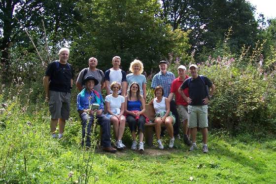
https://wtp2.appspot.com/wheresthepath.htm
Blast from the past: Monday 27th August 2007 we walked the last two stages of the Essex Way from Bradfield to Harwich. Here are some of the group relaxing on the Nomad's Bench.